Battling nerves on the Sunshine Coast Trail.
words & photography :: Paige Reimer
It took until our third day to find the sun on the Sunshine Coast. Mist filled the spaces between trees as Kianna and I made our way through the dense Sunshine Coast forest, losing sight of one another as we trudged through the eerie glow. And then the midday sun finally broke through, its rays piercing a haze that refused to fully lift.
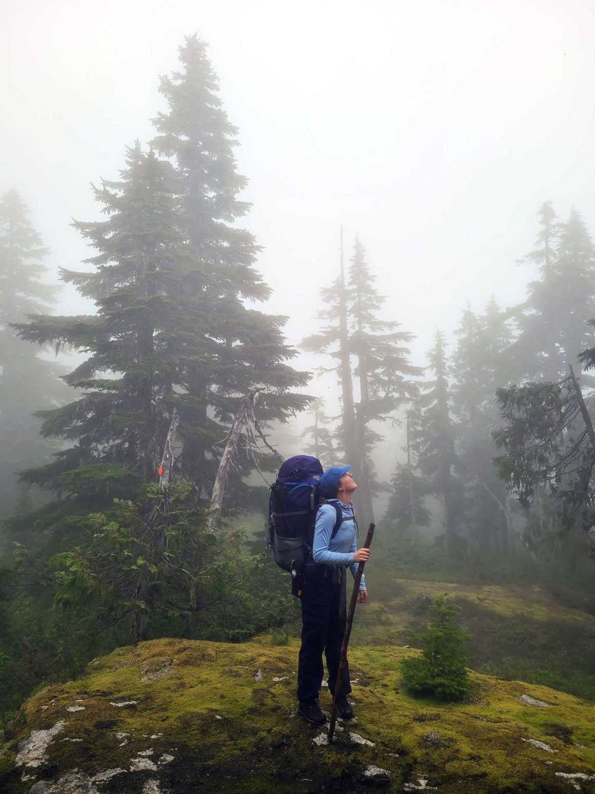
I was nervous, scared even. We had no map. Kianna had never been backpacking before, and my previous short trips definitely did not make me an expert. But my goal for the year had been to try new things, and I remember my dad telling me that being afraid to try something means it’s probably something worth doing. I was here because I’d wanted an adventure more than I feared one.
BC’s most popular coastal trails were either closed that summer or too busy and complicated to book, so when we learned about the Sunshine Coast Trail (SCT)—with multiple starting points, public-access huts and no need for a reservation—it seemed a perfect option. Kianna and I, along with Zephyr, Kianna’s dog, would hike from Lang Bay to Saltery Bay, covering 45 kilometres in four days.
How hard could it be, right?
That question felt more like a threat as I lifted my giant pack onto my back in the parking lot and snapped a photo of the route map from the side of the Lang Bay General Store. Lesson one, remember a map! But we felt we had an idea of which direction to go.
After taking a wrong turn and backtracking, our grainy phone-photo map eventually led us to a gravel logging road winding deeper into the forest, which seemed like the right direction. We followed this empty road for what felt like miles, the trees dampening the sound of any cars passing on the main road.
That question felt more like a threat as I lifted my giant pack onto my back in the parking lot and snapped a photo of the route map from the side of the Lang Bay General Store.
I sensed the fear begin to close in, but we kept walking forward. It’s not about not being scared, I told myself as we pushed along the seemingly never-ending gravel road, it’s about doing it anyway, right?
Finally, after an hour of doubtingly convincing ourselves we’d gone the wrong way again, we turned a corner and found a small parking lot with an SCT trail sign. As we officially started the trail, I breathed a sigh of relief. We can do this.
Raised on the big skies of the Canadian prairies, I felt small surrounded now by real-life giants with inspiring names like Douglas fir, western red cedar and Sitka spruce that towered over us as we trekked through the forest.
Related content from ML:
These trees along the Sunshine Coast Trail have grown tall due to the efforts of the Powell River Parks and Wilderness Society (PRPAWS) who, in 1992, organized to protect the some of the region’s last stands of old growth forest by creating a hiking corridor and three separate protected parks and wilderness areas, with construction on the first public shelter kicking off in 2009. In 2023 PRPAWS officially took the name qathet Parks & Wilderness Society, to incorporate the local Tla’amin Nation word meaning “working together.”
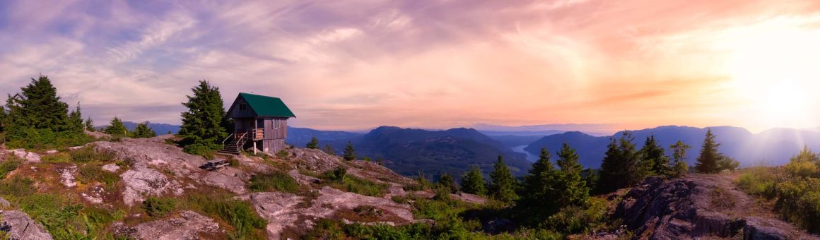
Today, the SCT is Canada’s longest hut-to-hut hiking trail, spanning 180 km across the Upper Sunshine Coast region with 16 public-use huts dotted along its length. Starting at Sarah Point, the trail follows the coast and then heads further inland, passing Powell and Lois Lake. It then snakes back to the coast, eventually ending at Saltery Bay. The two mountains along the trail, Tin Hat Mountain and Mount Troubridge, both offer summit huts with sweeping views of the coast below.
After a day spent hiking through rain and mist, Kianna and I arrived at one of the lower-elevation small wooden structures, sighing with relief. Open-air on the main floor with an enclosed loft for sleeping, the shelter was in good condition and fairly clean (all the huts were). Not that we were overly particular—that first night, I could have slept standing up.
As we unpacked, a group of four hikers showed up for the night: a mother and daughter, along with an aunt and her niece, who were hiking the same trail section we were. It was refreshing to see more people after a full day of solitude, but we said a quick goodnight and crawled into our sleeping bags at 8 p.m. Before sleep set in, my thoughts remained focused on the days ahead, my once-confident query of, How hard can it be? turning into something more like, How hard is it going to be?
The answer came the next day, on a stretch of trail known as the Troubridge Trudge—a 13 km stretch with 1,300 metres of elevation gain. This was where Kianna and I learned that hiking poles might have been helpful.
With some makeshift stick poles found in the forest, we started the daunting ascent. The rain and clouds continued to follow us throughout the day, and the constant elevation gain and heavy packs made our hiking slow.
“Do you ever wish we had picked up an easier hobby?” I asked Kianna as we continued our trudge up the mountain.
“Yes,” she muttered.
“Like knitting,” I suggested, in between gasps for air.
“Yeah, knitting sounds a lot better right now.”
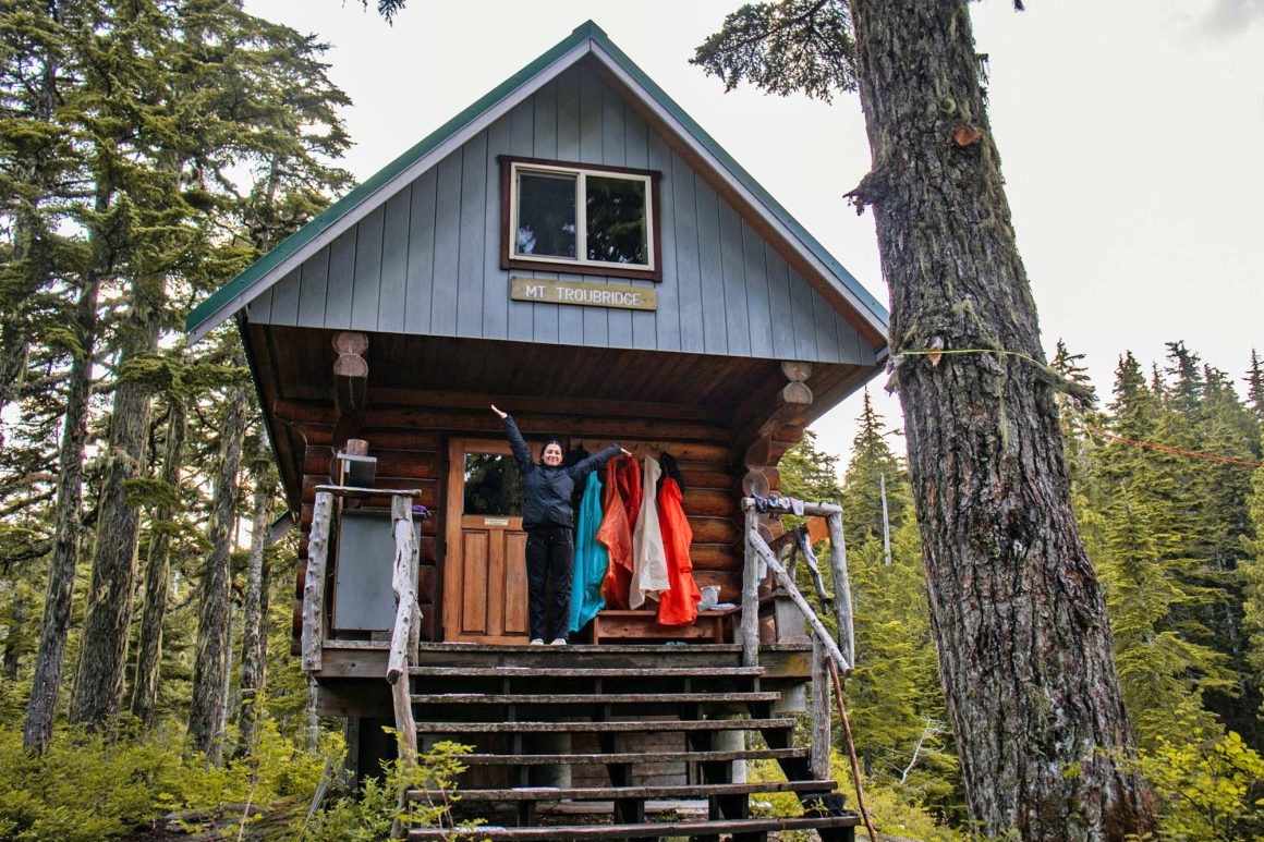
We continued the hike in silence, passing the occasional frog or slug as we made our way up into thick clouds that had us scanning ahead for the tiny orange trailblazing squares that were our sole guides. It was slow, and not very scenic, but we finally made it to the top of the mountain, the Mount Troubridge hut peeking out from the dense fog. A swarm of mosquitoes greeted us, but thankfully this hut was enclosed.
“Do you ever wish we had picked up an easier hobby?”
That evening, hiding from the bugs with our cabinmates from the previous night, we ate our dehydrated meals together and chatted. They were experienced backpackers, even though the two younger girls were only in their early 20s. The group asked about our trip and our gear, wondering if we would ever come back to finish the trail. That night we crawled into bed excited for the next day, dreaming of future hikes, knitting far from our minds.
As if in response to our lifted spirits, the sun finally came out the following day. Inching out of the thick clouds and dense forest, Kianna and I caught the welcoming sight of the ocean below. Thanks to hard use and Zephyr constantly chewing on them, Kianna and I were down to just a single trusty hiking stick each, but they remained very useful as we hiked down the steep mountain we had just climbed the day before.
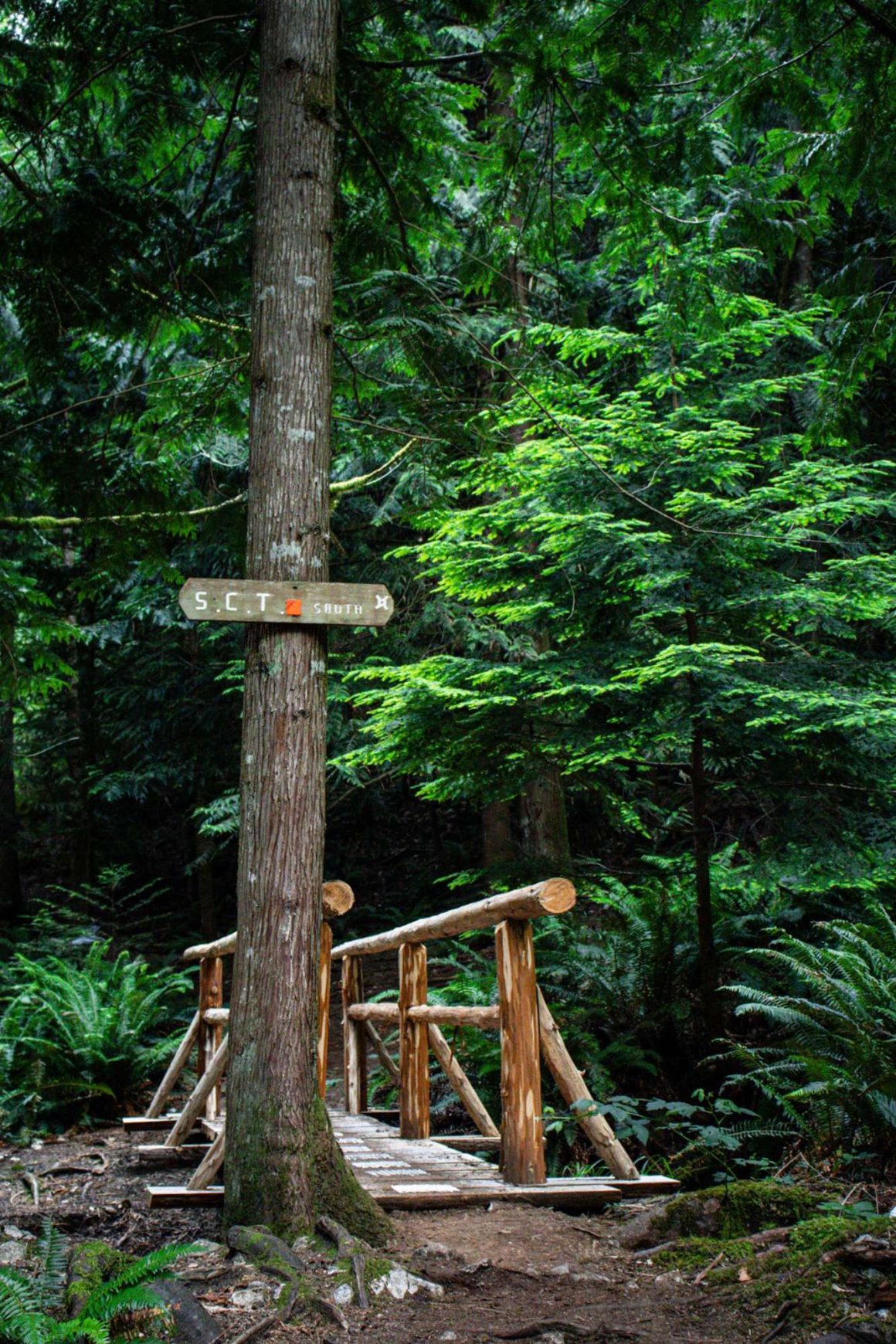
Despite our new friends and a couple days of experience, noticing fresh bear scat reignited my nerves and fears. We also missed some trail markers (were they even there in the first place?) and were beginning to think we’d gotten lost again when Zephyr barked behind us, attempting to chase something coming around the corner. My surprised terror abated when it turned out to be two other hikers, who happily allowed us to join them for the next few kilometres.
Fairview Hut—a small, enclosed structure with giant windows just steps from the ocean—was home for our final night of the trip. Kianna suggested we take advantage of the oceanfront property and we jumped in, the frigid ocean water rinsing off the sweat, dirt and anxieties of the past few days. We ate our dinner outside and looked for crabs and starfish in the water below until the sun went down, trying to make our final night on the trail last as long as possible. Eventually the soft sounds of the water outside and the smell of ocean in our hair lulled us to sleep.
As we completed our first trek on the SCT, we reflected on the challenges and lessons, realizing we probably could have been more prepared. Maybe by remembering to bring a map, or hiking poles—or leaving a car at the end of the trail (we thought maybe there’d be a bus).
Thankfully, a Saltery Bay local saw us sitting on the side of the road—tired, hungry and in desperate need of a shower—and took pity, offering us a ride. The three of us squeezed into Rick’s tiny car with our packs, saying goodbye to the Sunshine Coast Trail as he made the quick drive to our starting point.
As we loaded gear into our car, I felt like I was missing something important. To anyone else, our now-worn hiking poles probably looked like a couple old sticks leaning against a picnic table, but to us they meant much more. A symbol of powering through and finding a way to achieve our goal, despite our fears and rookie mistakes.
We drove back and found them right where we left them. Maybe next time we’ll have real hiking poles, but these simple, strong sticks proved we didn’t need all the experience or special gear to go on an adventure; we just needed to be brave enough to do it.

Check the ML Podcast!